The World's Angriest Volcanoes Revealed
Advertisement
8. Mount Nyiragongo, Congo
Advertisement
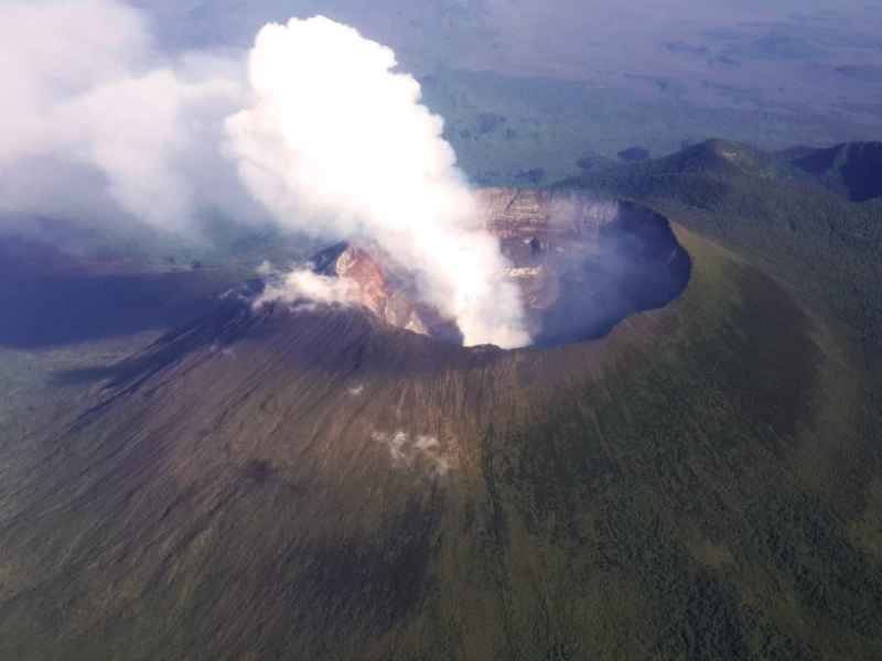
One of Africa's most active and perhaps deadly volcanoes is Mount Nyiragongo, a striking stratovolcano in the Democratic Republic of Congo's Virunga Mountains. Rising to 3,470 meters (11,385 feet), Nyiragongo is known for its uncommon geological feature—a permanent lava lake—which has enthralled both experts and explorers for decades. Often referred to as a "portal to the Earth's interior," this lava lake is among the biggest and most voluminous known in recent history and provides an unusual window into the planet's molten core.
The volcano's position inside the UNESCO World Heritage site Virunga National Park adds still another level of difficulty for management and research. The park boasts a varied mix of flora and fauna as well as critically endangered mountain gorillas, which makes balancing conservation efforts with volcanic risk management more difficult. Apart from directly endangering ecosystems and species, Nyiragongo's eruptions jeopardise the infrastructure of the park as well as the way of life of people living depending on ecotourism.
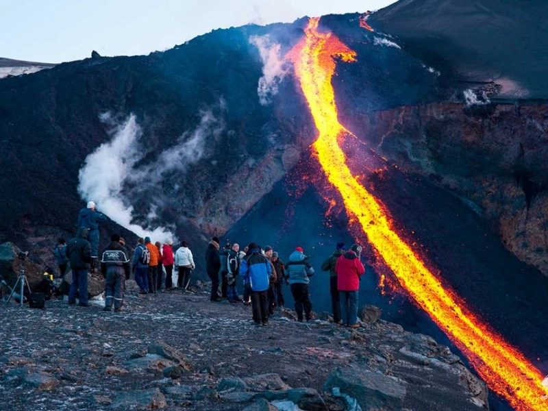
The eruptive history of Nyiragongo is typified by quite rare but highly dangerous episodes. An amazing forty percent of Africa's past volcanic outbursts come from the volcano and its neighbour, Nyamuragira. This figure emphasises the major part these volcanoes contribute to the geological scene of the continent. Highly fluid lava flows that can travel at remarkable speeds—sometimes reaching up to 60 km/h (37 mph) down the steep slopes of Nyiragongo define the eruptions of the volcano. The low silica component of the lava explains its unique fluidity; it reduces viscosity and lets the lava flow more quickly than from many other volcanoes.
One of the most disastrous volcanic catastrophes in modern African history is clearly the 2002 eruption of Mount Nyiragongo. Fissures on the southern side of the volcano opened on January 17, 2002, spewing torrents of lava towards the important urban centre of Goma, home to around a million people. About 15% of Goma's infrastructure and buildings are destroyed by the lava flows cutting through the city's centre. Over 120,000 people were displaced and the area suffered far-reaching social and economic effects from this terrible tragedy. Thousands of people fled across the border into neighbouring Rwanda, severely taxing resources and international relief efforts and creating a humanitarian crisis as well.
A sobering reminder of Nyiragongo's continuous menace to the area came with its most recent eruption in May 2021. Though less catastrophic than the 2002 eruption, this event nonetheless required the evacuation of tens of thousands of people from Goma and environs. The eruption made clear how vulnerable the local people still is and how much early warning systems and better monitoring are absolutely vital.
Because Mount Nyiragongo is in an area impacted by political unrest and limited resources, monitoring it presents special difficulties. In charge of observing Nyiragongo and Nyamuragira, the Goma Volcano Observatory works under challenging circumstances sometimes lacking sufficient resources and tools. Notwithstanding these difficulties, committed volcanologists and technicians labour nonstop to keep an eye on the volcano using a mix of satellite views, seismic monitoring, and gas emission studies. Supporting these initiatives depends critically on international cooperation, whereby experts from all around the world provide resources and knowledge to improve understanding and monitoring of Nyiragongo's activity.
Mount Nyiragongo's presence has significant ramifications for regional urban development and design. Driven in part by displacement from local conflicts, the fast expansion of Goma and nearby towns has resulted in more population exposure to volcanic dangers. Often occurring without enough thought given geological hazards, this urbanisation emphasises the importance of integrated measures to reduce disaster risk including assessment of volcanic hazards into long-term development plans.
Advertisement
You May Like